Kanata
West

Fast Facts
- Population: 76,284 (City of Ottawa Neighbourhood Study (sum of the six combined boundaries))
- Size: 40.54 km² (Computed from the combined City of Ottawa Neighbourhood Study boundary polygons)
- Distance from Parliament Hill: About 19.9 km west (straight-line distance)
- Who's building: Bill Teron (Beaverbrook), Richcraft Homes, Urbandale Construction, HN Homes
Overview
Kanata is a large suburban community in west Ottawa, developed from 1965 onward by Bill Teron as the planned community of Beaverbrook and incorporated as its own city in 1978. Kanata grew through the 1980s and 1990s into a major technology hub nicknamed "Silicon Valley North," anchored by companies such as Mitel and Nortel, before joining the City of Ottawa in the 2001 municipal amalgamation.
Boundaries
The City of Ottawa Neighbourhood Study covers this area with six separate boundaries, merged here, running roughly from Beaverbrook and Katimavik-Hazeldean in the north to Bridlewood, Emerald Meadows and Glen Cairn in the south, between the Greenbelt and Kanata Lakes-Arcadia to the west.
Map
History
Developer William (Bill) Teron began building Beaverbrook in 1964-65 as the first phase of a planned "garden city" on roughly 3,000 acres of former farmland, with Tiffany Crescent as the first street constructed. Teron's vision emphasized parks, pathways and a self-contained community distinct from typical postwar suburbs.
Ontario incorporated Kanata as a city in 1978, combining Beaverbrook with the former Township of March and parts of Goulbourn and Nepean Townships. Kanata became one of Canada's fastest-growing municipalities through the 1980s and 1990s.
Terry Matthews and Michael Cowpland, former Bell-Northern Research engineers, founded Mitel in Kanata in 1972-73; by the 1990s the company had spun off dozens of other technology firms, and the Ottawa Citizen's first "Silicon Valley North" reference appeared in 1980. Nortel Networks and Bell-Northern Research anchored the area's tech-sector growth through the following two decades.
Kanata's population reached roughly 59,700 by 2001, when it was amalgamated into the new City of Ottawa alongside Nepean, Gloucester, Vanier, Cumberland, Rockcliffe Park and four rural townships, ending its 23 years as an independent city.
Claim to Fame
Kanata's defining feature is its origin as a fully planned community founded by Bill Teron in 1965 and its subsequent growth into "Silicon Valley North," Canada's largest technology cluster outside the Toronto area, built around companies including Mitel and Nortel.
Notable People
- William (Bill) Teron — Developer who founded and master-planned Beaverbrook, the original community that grew into Kanata, starting in 1965.
- Merle Nicholds — Final mayor of the independent City of Kanata, serving from 1991 until the 2001 amalgamation into Ottawa.
Surrounding Neighbourhoods
Stittsville lies southwest, the Kanata North technology park lies north along March Road and Terry Fox Drive Extension, and Bells Corners and West Carleton lie east and northwest respectively.
New Developments
- —
Architecture
Beaverbrook's original 1960s-70s housing follows Bill Teron's planned-community layout of curving streets, parks and pathways. Later-built areas such as Katimavik-Hazeldean, Bridlewood, Glen Cairn and Kanata Lakes range from 1980s-90s subdivisions to more recent townhome and single-family developments in Kanata Lakes.
Restaurants
- Raahi Indian Dhaba — Indian
North Indian take-out restaurant at 782 Eagleson Road, serving curries, breads and street food.
Visit website - Kachiguda Junction — Indian
Indian restaurant at 501 Hazeldean Road, Unit 8, offering biryani, paneer and South Indian dishes.
Visit website - Choice Indian Restaurant — Indian
Pure-vegetarian Indian restaurant at 430 Hazeldean Road, Unit 4, operating since 1979.
Visit website - Kuma Takumi — Japanese
Ramen and Japanese kitchen at 484 Hazeldean Road, known for slow-simmered broths made with local ingredients.
Visit website
Bars
- D'Arcy McGee's Irish Pub — Irish pub
Irish pub at 655 Terry Fox Drive with live music, trivia and karaoke nights.
Visit website - Kelseys Original Roadhouse — Sports bar and grill
Sports-bar-style roadhouse restaurant at 130 Earl Grey Drive, near Kanata Centrum.
Grocery Stores
- Real Canadian Superstore — Supermarket
Large supermarket at 760 Eagleson Road.
Visit website
Pedestrian and Cycling
Beaverbrook's original planned layout includes an extensive network of parks and pathways, and pathway connections continue through Katimavik-Hazeldean, Bridlewood and Glen Cairn, while the major arterial roads (Terry Fox Drive, Eagleson Road, Hazeldean Road) are busier and driving-oriented.
Schools
- Earl of March Secondary School — Ottawa-Carleton District School Board
Secondary school at 4 The Parkway, serving Beaverbrook, Kanata Lakes and Katimavik-Hazeldean.
Visit website 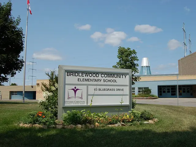 Bridlewood Community Elementary School — Ottawa-Carleton District School Board
Elementary school at 63 Bluegrass Drive, offering Early and Middle French Immersion.
Photo: L.K2, public domain, via Wikimedia CommonsVisit website- Holy Trinity Catholic High School — Ottawa Catholic School Board
Catholic secondary school at 180 Katimavik Road, serving grades 7 to 12.
Visit website
Amenities
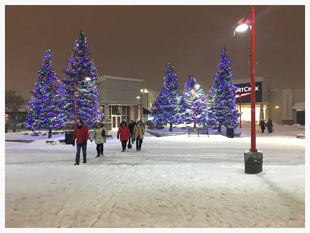 Kanata Centrum Shopping Centre — Shopping centre
Kanata's main retail and dining district, centred around Earl Grey Drive and Campeau Drive.
Photo: Ross Dunn, CC BY-SA 2.0, via Wikimedia Commons- Ottawa Public Library, Beaverbrook Branch — Library
Public library branch at 2500 Campeau Drive.
Visit website - Kanata Beaverbrook Community Centre (KBCA) — Community centre
Community centre at 1002 Beaverbrook Road, run by the Kanata Beaverbrook Community Association.
Visit website 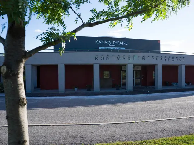 Ron Maslin Playhouse — Theatre
350-seat community theatre, home of Kanata Theatre, opened in 1996.
Photo: OttRider, CC BY-SA 3.0, via Wikimedia CommonsVisit website
Transit Options
OC Transpo bus routes run along Terry Fox Drive, Eagleson Road, Hazeldean Road and Campeau Drive. The area does not have its own O-Train station. Check octranspo.com for current route numbers, since the network is periodically redesigned.
Nearby on This Site
No listings yet in this area.
Official Information
Last verified: August 27, 2026